After Glenade Lough, we crossed over into County Sligo for one of the absolute highlights of this part of Ireland: the Gleniff Horseshoe. If you’re travelling through this region, this is genuinely a must-see — just be ready for a narrow road and not many places to pull over.
Our Suggested Route
The Gleniff Horseshoe is a single-lane loop road through a glacial valley, and doing it counter-clockwise worked well for us. Here’s the route we’d suggest:
- Start the loop at this point and drive counter-clockwise.
- Best viewpoint: the best spot we found along the whole loop was here — well worth pulling over if you can find a safe spot to do so.
- End the loop back near this point.
A quick word of warning: the road is genuinely narrow for most of its length, and passing places or spots to safely stop for photos aren’t always easy to find. Take it slow, especially if you’re driving anything larger than a regular car.
Key Facts About the Gleniff Horseshoe
The Gleniff Horseshoe is a roughly 10 km single-lane loop road running through a glacial valley in the northern Dartry Mountains, near Ballintrillick in County Sligo, about 25 km from Sligo Town. The valley was carved out by glaciers more than a kilometre thick during the last Ice Age, tens of thousands of years ago, leaving behind the dramatic horseshoe-shaped landscape you drive through today. The road is flanked by some of the region’s best-known peaks, including Truskmore, Tievebaun, and Benwiskin, with the Cliffs of Annacoona rising at the centre of the horseshoe and views stretching out toward Donegal Bay on a clear day.
The valley is also steeped in local folklore. One well-known legend ties the area to Diarmuid and Gráinne, with a cave along one of the cliff faces said to be linked to their story — though it’s worth noting that reaching the cave itself involves a genuinely dangerous climb and isn’t something we’d recommend attempting. A separate, much lighter stop along the route is “Magic Hill,” a spot where an optical illusion in the landscape makes it look like your car rolls uphill when you release the handbrake — a fun little detour if you spot it.
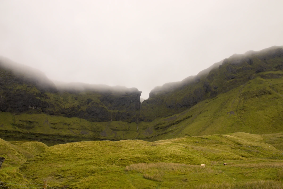
Hiking Options in the Gleniff Horseshoe
If you want to get out of the car and explore further, the Gleniff Horseshoe (Benwiskin) Trail is the main option in the area — a roughly 10 km loop (around 13.5 km including approach) rated moderate, taking about 2.5 hours. It starts near the Benwiskin Centre, where there’s roadside parking, and combines country roads with forest trail sections, including a stretch through the 19th-century Bartyes Mill site, past native Irish trees, small streams, and waterfalls. Dogs are allowed on lead, and sturdy footwear is recommended given the mix of terrain.
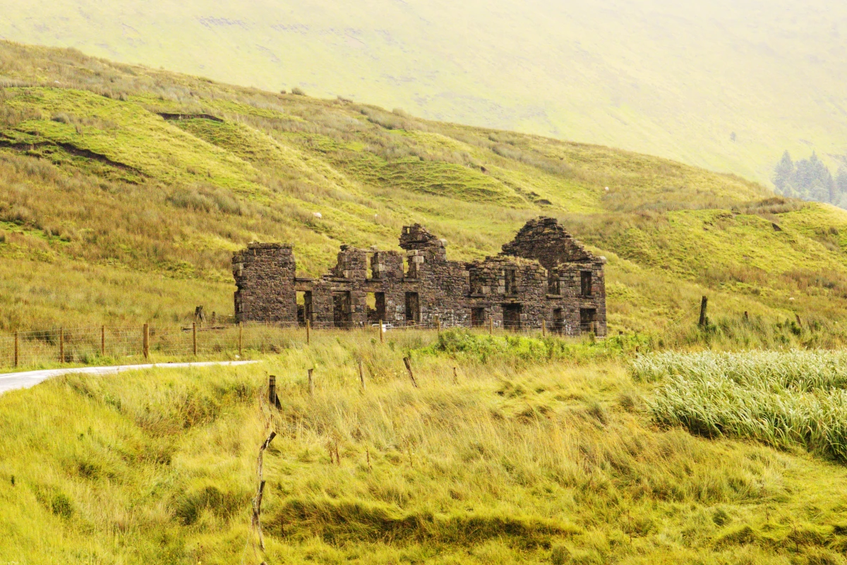
What to See Along the Way
Beyond the general scenery, there are a handful of specific spots worth looking out for as you drive the loop. The ruins of the old Barytes Mill, a 19th-century mining site, sit near the start/end of the route and are a good reference point for parking if you want to get out and walk part of the valley. Further along, keep an eye out for an old schoolhouse ruin, a small stone structure that makes for a genuinely good photo stop and gives a sense of how remote this valley once was to live in. Towering above it all is Benwiskin, one of the distinctive “table mountain” peaks of the Dartry range, alongside Truskmore, Tievebaun, and — visible in the distance — Benbulben.
Practical Tips
- The road is narrow and mostly single-lane — drive carefully and be ready to pull in for oncoming traffic.
- Stopping spots are limited, so take advantage of any pull-off you find, especially near the best viewpoints.
- Don’t attempt to climb to Diarmuid and Gráinne’s Cave — it looks tempting from photos online, but the climb is genuinely hazardous.
- Allow more time than you’d expect for such a short loop — between the narrow road and the scenery, it’s not a drive to rush.
For more background on the area, the official Discover Ireland page and Sligo Walks are both good places to check current trail conditions before you go.
Our Gleniff Horseshoe drive on video
Narrow roads, towering cliffs and a valley that feels completely untouched. Here’s how our drive around the Gleniff Horseshoe went, and why it became the highlight of our day.
Gleniff Horseshoe: 🎥 Drive the loop with us and see the view from the best viewpoint – watch from 05:34.
Or watch the full video of our second day in Ireland, from Lough Key to the wild Gleniff Horseshoe.

Frequently Asked Questions
Is the Gleniff Horseshoe free to visit? Yes. It’s a public road through the valley, so there’s no entry fee to drive or walk the loop.
Is the Gleniff Horseshoe road suitable for campervans or larger vehicles? It can be done, but the road is notoriously narrow with few passing places, so it takes more care and patience than in a regular car. If you’re driving anything wide or long, go slowly and be prepared to reverse to a passing point if needed.
What is there to see along the Gleniff Horseshoe? Highlights include the ruins of the 19th-century Barytes Mill near the start of the loop, an old schoolhouse ruin that makes for a good photo stop, and the surrounding peaks — Benwiskin, Truskmore, and Tievebaun — with Benbulben visible in the distance.
Is the Gleniff Horseshoe worth visiting, and when is the best time to go? Yes, we’d call it a genuine must-see for this part of Ireland. Like most of the country, the weather is unpredictable, so aim for a clear day if you can — the views depend heavily on visibility, and it’s a much better experience without rain or fog rolling in over the valley.
How long is the Gleniff Horseshoe drive? The loop road itself is roughly 8.5–10 km, taking around 25–30 minutes to drive without stops, or closer to an hour if you stop to take in the views.
Is the Gleniff Horseshoe road difficult to drive? It’s single-lane for most of its length with limited passing places, so it requires care, but it’s manageable in a normal car or van driven cautiously.
Can you visit Diarmuid and Gráinne’s Cave? Technically yes, but the climb up to it is genuinely dangerous and not recommended for most visitors.
Is there a hiking trail in the Gleniff Horseshoe? Yes, the Benwiskin Trail is a roughly 10 km moderate loop starting near the Benwiskin Centre, taking about 2.5 hours.
What is Magic Hill? A spot along the route where an optical illusion makes it look like your car rolls uphill when you take your foot off the brake.
Plan your own trip
What we used on our Ireland road trip
📶 Mobile data
We used a local Three SIM — an eSIM is the easiest alternative if you want data from the moment you land. Get an Ireland eSIM from Airalo
🚁 Our drone
Most of our aerial shots were filmed with the Potensic Atom 2. Check the current price on Amazon
Some of these are affiliate links. If you book or buy through them, we may earn a small commission at no extra cost to you. It helps us keep the road trip — and this blog — going.
Watch the road trip
See Ireland from the driver's seat
Every stop on this blog is also on our YouTube channel — the drives, the detours and the van-life reality in between.
Subscribe on YouTubeOur Ireland road trip, stop by stop
← Previous stop: Glenade Lough View, a cliff-lined valley in Leitrim
Next stop (day 3) → Galway, our honest take on the city
🗺️ See every stop on our interactive Ireland road trip map.
Planning your own Ireland road trip? Check our Glenade Lough View post, our Arigna Mining Experience post, and our Ireland facts before you go.