From Screebe Waterfall, we continued to Maam Cross and joined the N59 – but not for long. A little further on, we turned onto the R344, and this is where the drive really surprised us. The road runs north through the Inagh Valley, past Lough Inagh, squeezed between two mountain ranges. In this post we share what the drive is like, where you can stop, what to know if you’re in a van, and whether it’s worth leaving the N59 for.
Inagh Valley at a glance
- LocationR344 through the Inagh Valley, between Recess and Kylemore, Connemara, Co. Galway
- Main viewpointLough Inagh Viewpoint – small roadside car park that fills up quickly
- Alternative stopLough Inagh Point, a little further north along the lake
- Entry feeFree
- FacilitiesNone at the viewpoints
- Van-friendly?Yes – narrower than the N59, so take it slowly
- Best forAnyone heading to Kylemore, Leenane or Westport
- Worth it?Yes – hardly a detour, far better views than the N59
What Is the Inagh Valley?
The Inagh Valley is a long, open glacial valley in the heart of Connemara, County Galway. The R344 runs through it from near Recess in the south to the N59 near Kylemore in the north.
On one side rise the Twelve Bens (also called the Twelve Pins). On the other, the Maumturk Mountains. For most of the drive, you’re not looking at mountains in the distance – you’re driving right between them.
A few facts about the mountains around you:
- The Twelve Bens form the western wall of the valley. Bencorr (711 m) and Derryclare (677 m) look straight down onto the lake. Part of the range belongs to Connemara National Park, and its highest peak, Benbaun (725 m), is the highest mountain in County Galway.
- The Maumturks form the eastern side. Their highest summit, Binn idir an Dá Log, reaches 702 m, and the range is part of the Western Way long-distance trail. According to Galway Tourism, the rocks are over 400 million years old.
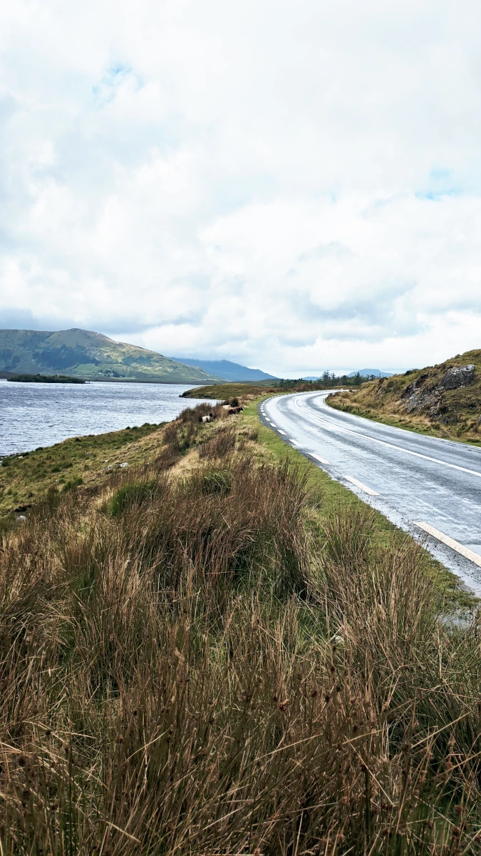
Lough Inagh: The Lake in the Middle of the Valley
Ahead of us was Lough Inagh, a long mountain lake surrounded by bogland and mountains. It covers around 309 hectares and is up to 22 metres deep, according to a fish stock survey by Inland Fisheries Ireland. It drains south into Derryclare Lough and is part of the Ballynahinch river system.
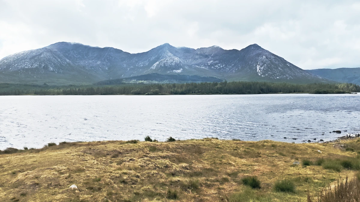
Lough Inagh is also well known among anglers for salmon, sea trout and brown trout. Fishing on Lough Inagh and Derryclare is managed through Lough Inagh Lodge – more details are listed on Connemara.ie.
Lough Inagh Viewpoint – and Why We Didn’t Stop There
The best-known stop is the Lough Inagh Viewpoint, right beside the road. On a calm day, the water reflects the mountains like a mirror.
The viewpoint’s small parking area was already full, so we kept driving. But don’t worry: there are more places to stop along the lake.
Lough Inagh Point: Our Stop Instead
A little further on, we pulled over at Lough Inagh Point.
If the official viewpoint is busy when you arrive, don’t turn around. Just keep going and look for the next pull-in along the lake. You’ll often get a quieter view without the crowd.
Driving the R344 in a Van
If you’re in a van or motorhome, the R344 is narrower than the N59, and there are fewer places to pass. Take it slowly, and be ready to pull in for oncoming traffic, especially on the bends.
In our Ford Tourneo Custom, it was an easy drive. The road is in good condition, and as long as you’re not in a hurry, there’s nothing to worry about. Larger motorhomes will need a bit more patience – and a bit more luck with free parking spots at the viewpoints.
Is the Inagh Valley Worth It?
So, is the Inagh Valley worth it, or should you just stay on the N59?
If you’re heading towards Kylemore or Leenane anyway, take the R344. It’s hardly a detour, and the views are so much better. You’re not just driving past the mountains. You’re driving right through them.
And even in bad weather, it’s worth it. Low clouds and passing showers don’t ruin the Inagh Valley – they’re part of what makes it feel so wild.
Our Inagh Valley drive on video
A quiet road, a long lake and mountains rising on both sides. Here’s how our drive along the R344 through the Inagh Valley went, and where we ended up stopping at Lough Inagh.
Inagh Valley: 🎥 Drive the R344 with us and see the view over Lough Inagh – watch from 10:36.
Or watch the full video of our third day in Ireland, from Galway to Killary Fjord and Aasleagh Falls.

Inagh Valley FAQ
Where is the Inagh Valley?
The Inagh Valley is in Connemara, County Galway, in the west of Ireland. The R344 runs through it from near Recess in the south to the N59 near Kylemore Abbey in the north.
Which mountains surround Lough Inagh?
The Twelve Bens rise on the western side of Lough Inagh, with Bencorr and Derryclare directly above the lake. The Maumturk Mountains rise on the eastern side.
Is the R344 through the Inagh Valley suitable for vans and motorhomes?
Yes. The road is narrower than the N59, so take it slowly and pull in for oncoming traffic. In our Ford Tourneo Custom, it was an easy drive; larger motorhomes just need more patience.
Where can you stop to see Lough Inagh?
The best-known stop is the Lough Inagh Viewpoint beside the R344. Its parking area is small and fills up quickly, but there are more pull-ins along the lake, such as Lough Inagh Point.
Is the Inagh Valley worth the detour from the N59?
If you’re travelling towards Kylemore, Leenane or Westport anyway, yes. The R344 is hardly a detour and gives you far better mountain views than staying on the N59.
Can you fish on Lough Inagh?
Yes. Lough Inagh is known for salmon, sea trout and brown trout. Fishing on Lough Inagh and nearby Derryclare Lough is arranged through Lough Inagh Lodge.
Where We Went Next
Eventually, the R344 brought us back to the N59, and we turned right towards Leenane and Westport.
We thought we’d already seen the best part of the drive.
We were wrong. A few minutes later the road opened up at the Killary Fjord Viewpoint above Killary Harbour.
Plan your own trip
What we used on our Ireland road trip
📶 Mobile data
We used a local Three SIM — an eSIM is the easiest alternative if you want data from the moment you land. Get an Ireland eSIM from Airalo
🚁 Our drone
Most of our aerial shots were filmed with the Potensic Atom 2. Check the current price on Amazon
Some of these are affiliate links. If you book or buy through them, we may earn a small commission at no extra cost to you. It helps us keep the road trip — and this blog — going.
Watch the road trip
See Ireland from the driver's seat
Every stop on this blog is also on our YouTube channel — the drives, the detours and the van-life reality in between.
Subscribe on YouTubeOur Ireland road trip, stop by stop
← Previous stop: Screebe Waterfall, a quick roadside stop on the R336
Next stop → Killary Fjord Viewpoint, a free roadside stop above Killary Harbour
⛴️ Planning your own trip over? Here’s how our 24-hour ferry from Dunkirk to Rosslare went.
🗺️ See every stop on our interactive Ireland road trip map.
Planning your own Connemara road trip? Check our Screebe Waterfall guide, our Cartron Harbour guide, our Killary Fjord Viewpoint post, our interactive Ireland road trip map, and our Ireland facts before you go.